

Dalwhinnie Voices
No: 509 Contributor: Douglas Abercrombie Year: 1900
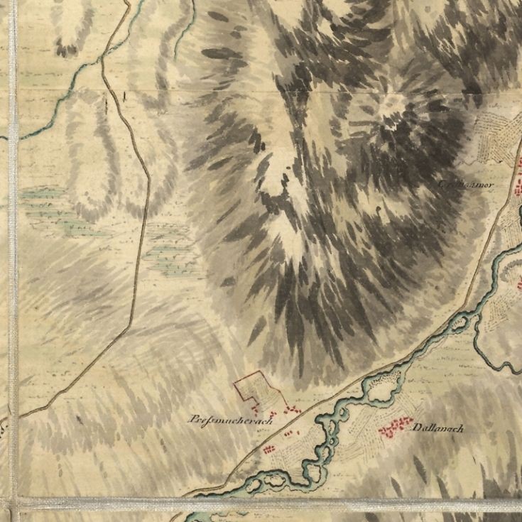
Map showing clachans The clachan or settlement of Pressmucherach and also Dallanach from an ancient map.Such clachans or settlements were situated all along the Truim-"Lechden" near Cuaich,"Inchlea",and others.Now totally obliterated.However,it is likely that old field systems or crop marks may reveal their location.
Picture added on 03 September 2012 at 11:16
Maps